


The accuracy of the best topographic sources.
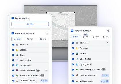
Export with confidence using data from the best sources, for professional-grade precision.


Coming soon
Based on global data


Compatible with your favorite CAD software.


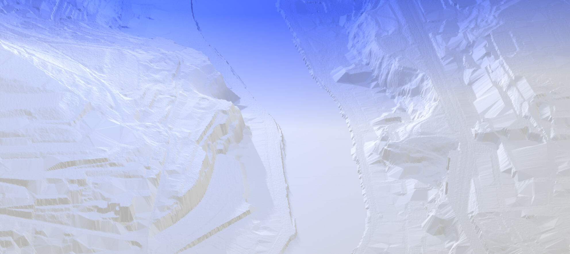

High-resolution rendering.
Access superior detail levels with reliable DTMs* and optimized contour lines.


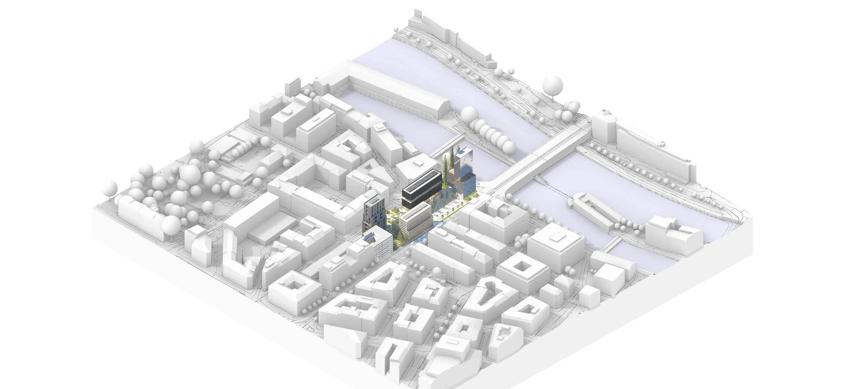
Up to 50 km².
Download landscape and territorial models with unmatched ease.
'%3e%3cpath%20d='M31.7524%2016.9552L27.7524%2020.9552C27.6596%2021.0482%2027.5493%2021.1219%2027.4279%2021.1722C27.3065%2021.2226%2027.1763%2021.2485%2027.0449%2021.2485C26.9135%2021.2485%2026.7834%2021.2226%2026.662%2021.1722C26.5406%2021.1219%2026.4303%2021.0482%2026.3374%2020.9552L24.3374%2018.9552C24.1498%2018.7675%2024.0444%2018.513%2024.0444%2018.2477C24.0444%2017.9823%2024.1498%2017.7278%2024.3374%2017.5402C24.5251%2017.3525%2024.7796%2017.2471%2025.0449%2017.2471C25.3103%2017.2471%2025.5648%2017.3525%2025.7524%2017.5402L27.0449%2018.8339L30.3374%2015.5402C30.5251%2015.3525%2030.7796%2015.2471%2031.0449%2015.2471C31.3103%2015.2471%2031.5648%2015.3525%2031.7524%2015.5402C31.9401%2015.7278%2032.0455%2015.9823%2032.0455%2016.2477C32.0455%2016.513%2031.9401%2016.7675%2031.7524%2016.9552ZM18.0449%2019.9577C19.6125%2018.9813%2020.8195%2017.5209%2021.4833%2015.7975C22.147%2014.0741%2022.2314%2012.1814%2021.7236%2010.4057C21.2159%208.6301%2020.1436%207.06813%2018.6691%205.95615C17.1946%204.84417%2015.398%204.24268%2013.5512%204.24268C11.7044%204.24268%209.90779%204.84417%208.43326%205.95615C6.95874%207.06813%205.88649%208.6301%205.37874%2010.4057C4.87098%2012.1814%204.95536%2014.0741%205.61909%2015.7975C6.28282%2017.5209%207.4898%2018.9813%209.05742%2019.9577C6.47617%2020.8027%204.15367%2022.3814%202.28617%2024.6039C2.16391%2024.7493%202.08556%2024.9264%202.06029%2025.1146C2.03501%2025.3028%202.06386%2025.4944%202.14345%2025.6668C2.22305%2025.8392%202.3501%2025.9854%202.50974%2026.0883C2.66938%2026.1912%202.85501%2026.2464%203.04492%2026.2477H24.0449C24.2355%2026.2479%2024.4221%2026.1936%2024.5829%2026.0913C24.7436%2025.989%2024.8718%2025.8429%2024.9523%2025.6702C25.0328%2025.4975%2025.0623%2025.3054%2025.0373%2025.1165C25.0123%2024.9276%2024.9338%2024.7497%2024.8112%2024.6039C22.9424%2022.3814%2020.6199%2020.8027%2018.0449%2019.9577Z'%20fill='%234D6ED9'/%3e%3c/g%3e%3cdefs%3e%3cclipPath%20id='clip0_444_113291'%3e%3crect%20width='32'%20height='32'%20fill='white'%20transform='translate(0.0449219%200.247559)'/%3e%3c/clipPath%3e%3c/defs%3e%3c/svg%3e)
Accessible to all.
Architects, urban planners, landscape designers, designers, engineers, students, and more.

*Level of Details
Available only in Germany and Switzerland.
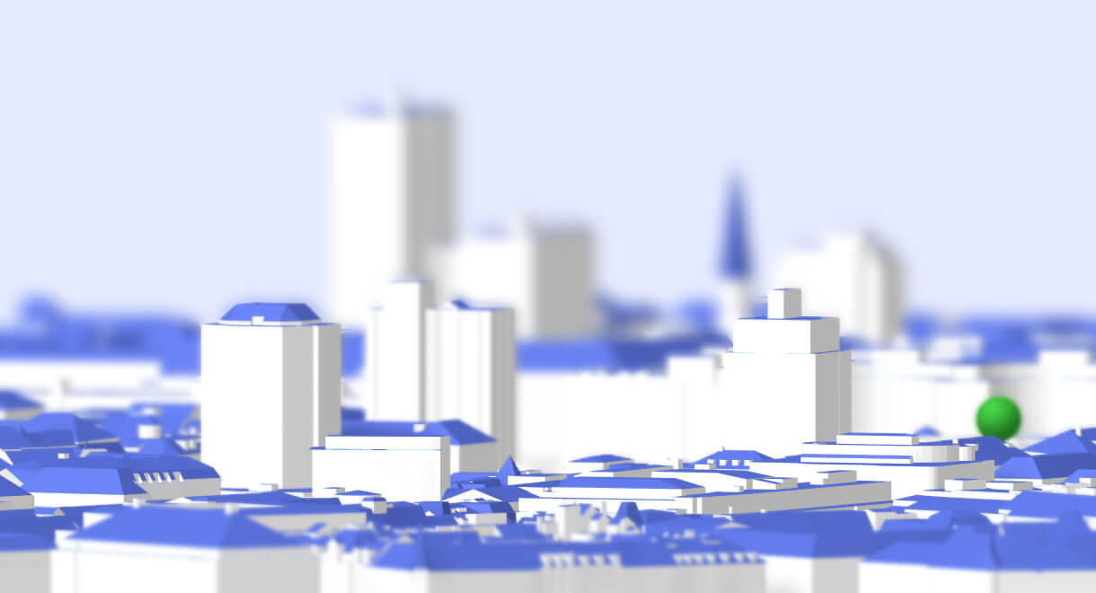

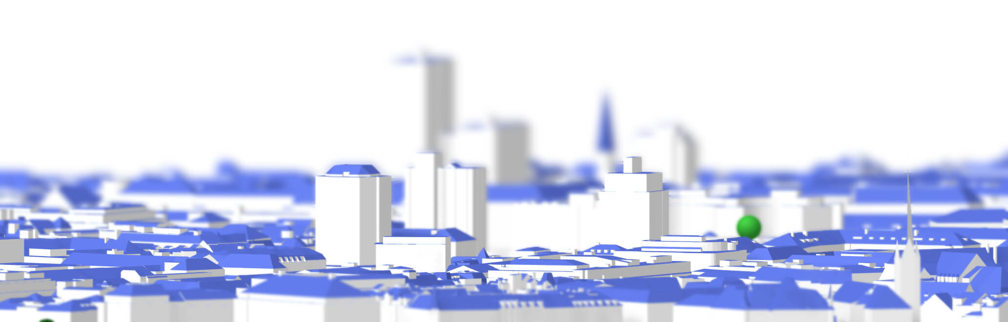
LoD2* Available.
Access a more accurate 3D representation of rooftops.


Click, Click. Done.
Select, export: your export can be created in just two clicks.


Let’s hear from our users.
People use TopoExport every month.
Referenced by businesses and individuals.