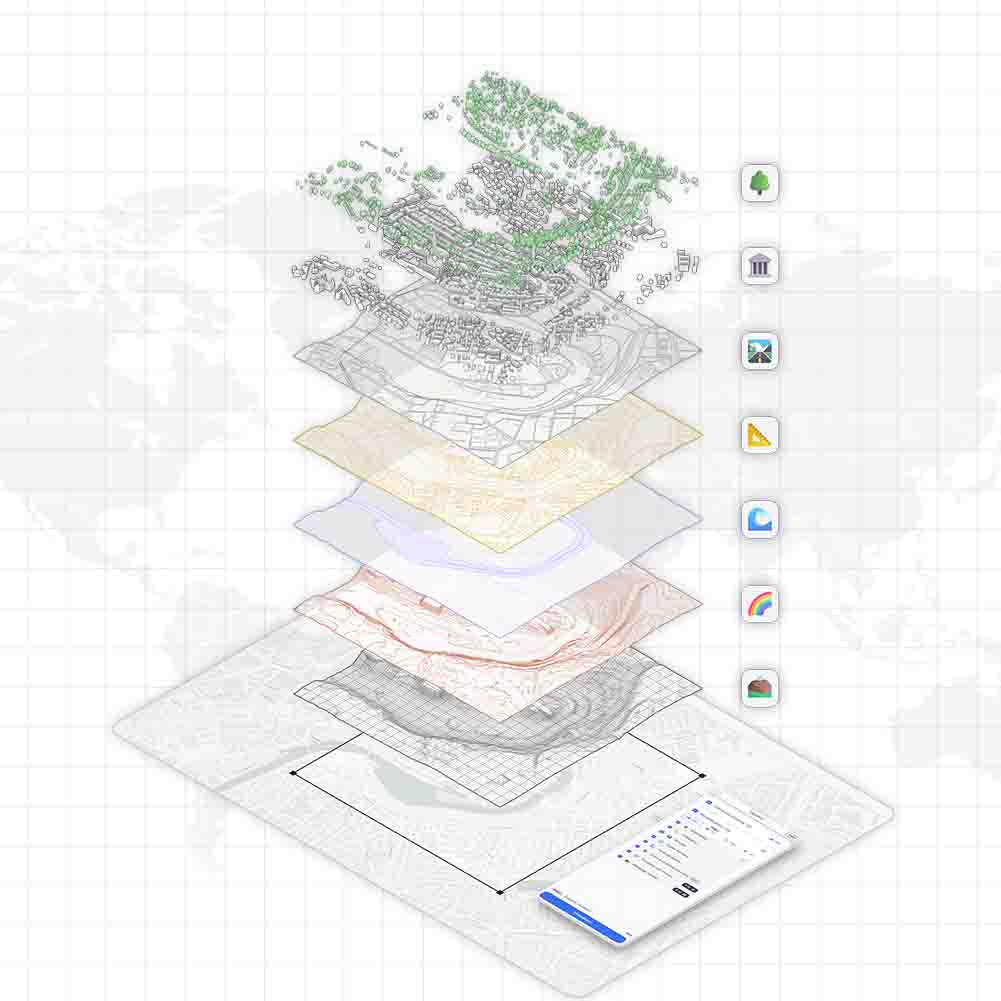
TopoExport is moving towards on-demand generation of high-fidelity digital twins using HD LiDAR data. By combining LiDAR point clouds with GIS synthesis we automatically generate detailed terrain models, individual trees and LoD2 buildings ready for architecture, landscape and BIM workflows.
Update
✨ Update: A New Generation of Exports
A new generation of TopoExport data exports is now available featuring full 3D meshes for roads, hydrography and green spaces. Combined with an optimized layer structure and a completely redesigned computation engine, these enhancements significantly accelerate workflows and improve compatibility with Rhino, Revit, ArchiCAD and Vectorworks.
LiDAR
🍀 Soon a Complete Vegetation Digital Twin For France
A nationwide, high-resolution vegetation synthesis is coming to TopoExport. Powered by IGN LiDAR HD, this new dataset will deliver fully automated mapping of arboreal, shrub,and herbaceous strata across France available in 2D and 3D for GIS, CAD and BIM workflows.
LiDAR
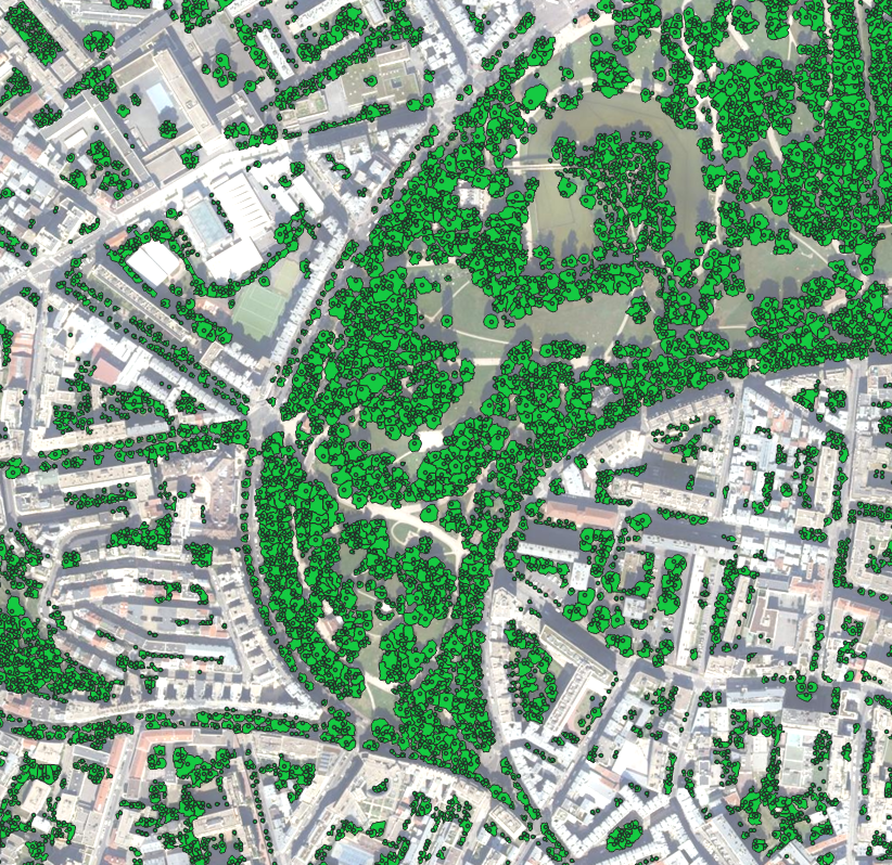
🍂 Automatic Tree Segmentation and Color Analysis (Belleville Park - Paris - France)
Explore 1 km² of Belleville Park in Paris where each tree is individually segmented and color-coded using HD LiDAR data, revealing precise canopy outlines and height variations.
LiDAR
🌿 Auto Detection of the French Hedgerow Networks
TopoExport introduces its new automatic hedgerow detection system, built from IGN’s HD LiDAR data. A major step forward for mapping ecological networks, rural landscapes, and vegetation structures across France.
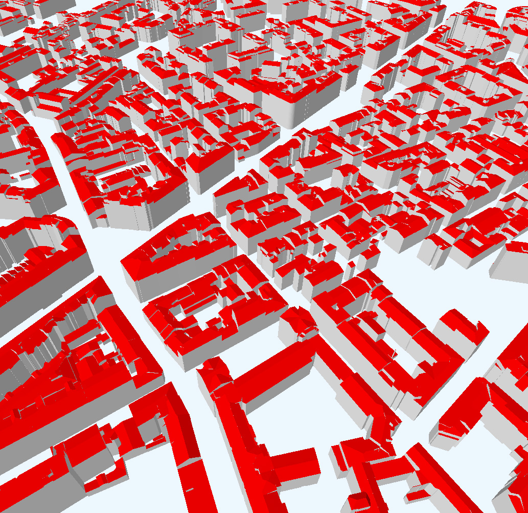
LoD2
🤖 Stop Modeling Roofs by Hand
We successfully generated LOD2 buildings automatically from IGN’s LiDAR HD data, including roof and wall segmentation over the city of Lyon. This marks a major milestone toward our 2026 goal: delivering a nationwide digital twin of all French buildings with detailed roof geometry.
LiDAR
🌳 AI Solutions for Tree Detection (Beta Available in Paris)
Automatic segmentation of trees from IGN LiDAR data. Discover how TopoExport uses high resolution 3D point clouds to generate precise, ready to use tree cover datasets for architects, planners and landscape designers.
TopoExport
⚙️ What Is TopoExport ?
TopoExport is a web app that let you generate 2D maps and 3D models anywhere in the world, using the best available geospatial data.